


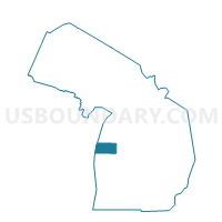
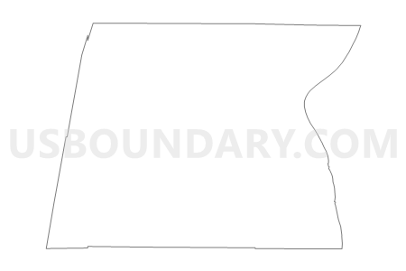
Voting Districts not defined, Mason County, Michigan
About
Outline

Summary
| Unique Area Identifier | 598205 |
| Name | Voting Districts not defined |
| County | Mason County |
| State | Michigan |
| Area (square miles) | 732.11 |
| Land Area (square miles) | 0.00 |
| Water Area (square miles) | 732.11 |
| % of Land Area | 0.00 |
| % of Water Area | 100.00 |
| Latitude of the Internal Point | 43.99663630 |
| Longtitude of the Internal Point | -86.75081370 |
Maps


Graphs
Select a template below for downloading or customizing gragh for Voting Districts not defined, Mason County, Michigan


Neighbors
Neighoring Voting District (by Name) Neighboring Voting District on the Map
- Voting District 1012804000001, Manistee County, MI
- Voting District 1053432000001, Mason County, MI
- Voting District 1053622000001, Mason County, MI
- Voting District 1053622000002, Mason County, MI
- Voting District 1054964001001, Mason County, MI
- Voting District 1054964003001, Mason County, MI
- Voting District 1056360000001, Mason County, MI
- Voting District 1056360000002, Mason County, MI
- Voting District 1057722000001, Mason County, MI
- Voting District 1276356000001, Oceana County, MI
- Adell - V 9999 Voting District, Sheboygan County, WI
- CATO - T 9999 Voting District, Manitowoc County, WI
- Voting Districts not defined, Manistee County, MI
- Voting Districts not defined, Oceana County, MI
Top 10 Neighboring County Subdivision (by Population) Neighboring County Subdivision on the Map
- Ludington city, Mason County, MI (8,076)
- Hamlin township, Mason County, MI (3,408)
- Pere Marquette charter township, Mason County, MI (2,366)
- Filer charter township, Manistee County, MI (2,325)
- Pentwater township, Oceana County, MI (1,515)
- Summit township, Mason County, MI (924)
- Grant township, Mason County, MI (909)
- County subdivisions not defined, Mason County, MI (0)
- County subdivisions not defined, Manistee County, MI (0)
- County subdivisions not defined, Sheboygan County, WI (0)
Top 10 Neighboring Place (by Population) Neighboring Place on the Map
Top 10 Neighboring Unified School District (by Population) Neighboring Unified School District on the Map
- Ludington Area School District, MI (15,954)
- Manistee Area Schools, MI (12,921)
- Mason County Central Schools, MI (7,804)
- Pentwater Public School District, MI (2,262)
- School District Not Defined (Water), WI (0)
Top 10 Neighboring State Legislative District Lower Chamber (by Population) Neighboring State Legislative District Lower Chamber on the Map
- State House District 101, MI (92,671)
- State House District 100, MI (86,569)
- Assembly District 2, WI (61,009)
- Assembly District 59, WI (58,836)
Top 10 Neighboring State Legislative District Upper Chamber (by Population) Neighboring State Legislative District Upper Chamber on the Map
- State Senate District 34, MI (275,923)
- State Senate District 35, MI (261,943)
- State Senate District 1, WI (180,989)
- State Senate District 20, WI (176,381)
Top 10 Neighboring 111th Congressional District (by Population) Neighboring 111th Congressional District on the Map
Top 10 Neighboring Census Tract (by Population) Neighboring Census Tract on the Map
- Census Tract 7, Manistee County, MI (4,078)
- Census Tract 9502, Mason County, MI (3,601)
- Census Tract 9505, Mason County, MI (3,560)
- Census Tract 9503, Mason County, MI (3,429)
- Census Tract 9508, Mason County, MI (2,748)
- Census Tract 108, Oceana County, MI (2,725)
- Census Tract 9900, Mason County, MI (0)
- Census Tract 9900, Oceana County, MI (0)
- Census Tract 9900, Manistee County, MI (0)
- Census Tract 9900, Manitowoc County, WI (0)